State Highway 85, the 160km-long romp between Palmerston and Alexandra in Central Otago, is one my favourite road-tripping encounters, with the striking scenery and tucked away treats of the Maniototo at its heart. Colloquially known as the “Pigroot”, the highway’s sobriquet can be traced back to when the area was surveyed in 1863 by John Thomson.
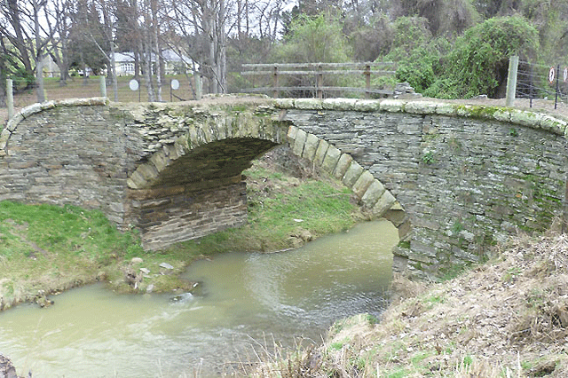
The valley was overrun by wild pigs, who were completely fearless of people. Fifteen minutes out of Palmerston, pullover at the signpost for the McCormicks Creek Bridge, which most travellers race past. Built in 1869, this gorgeous schist arch bridge, is one of the last examples of the old coach bridges, erected during the Otago goldrush.
Whether the region is clad in autumn’s russets, winter’s heavy snow-coat or just baking in the golden sun, it’s a landscape of awe. After twisting and turning through the Inch Valley and the Kakanui Ranges, the fabled high plateau of the Maniototo unfurls before you, as you near Kyeburn on SH85. Prior to the goldrush, flowing red tussocks thickly carpeted the landscape. (Maniototo translates as “Plains of Blood.”)
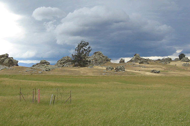
Fires have destroyed much of the original grasslands, but as you approach Kyeburn, you can see the best remnant of the blood red tussocks. Loosely scattered with schist rock stacks in wondrously free form designs, the frontier feel to this big sky country is intoxicating, a roll call of Graham Sydney paintings in 3D. Ambling past Ranfurly, the Art Deco town of the South, veer off SH85 for the short 10km diversion to Naseby.
Nestled at the base of the Mt. Ida Range, you could be forgiven for thinking this fairy-tale village has been teleported direct from Toytown. Walk the lanes of this pretty, perfectly-formed village to delight in the clutch of rose-clad cottages, old wooden churches, elegant stone buildings and storied pubs.
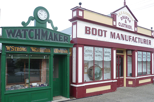
There’s the Watchmakers, Bootmakers and Drapers shops, along with the Apothecary, possibly New Zealand’s oldest standing two storey adobe (mud brick) building. The Old Doctor’s Residence is a graceful old kauri villa, as is the Monkey Puzzle House, previously the Borough Clerk’s house and now a B&B, named in honour of the lofty Monkey Puzzle tree in the front garden.
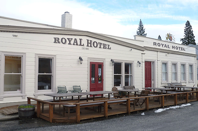
But the prize draw is the kauri-timbered Royal Hotel, built in 1863, and run by Jill and Peter Derbyshire. Just as it was 150 years ago, the Royal Hotel remains the social nerve centre of Naseby, where stories are traded over the roaring fire, crisp lagers and hearty pub fare.
Synonymous with curling, its legacy can be traced directly to the goldrush, as it was Scottish prospectors who popularised the sport in Naseby, in the 1860s. Curling is now played year-round, indoors, at Naseby’s International Curling Rink, the only such facility in the Southern Hemisphere – in close proximity to the downhill luge course.20km from Naseby, Kyeburn Diggings was the northernmost town of the Maniototo – now a ghost town where the sole survivor is the Dansey’s Pass Coaching Inn.
Offering hearty fare, boutique accommodation and a superb bar packed with curios, it’s a compelling experience with an unmistakable frontier charm. The long and low-slung hotel remains a stirring roadside refuge amid the monochromatic terrain of imposing brown hills. First built in 1862 as a corrugated-iron shack, it was rebuilt for beer, a decade later.
The stonework was constructed by a mason known as Happy Bill, who received one pint for every schist boulder he shaped and laid. It’s a stunning reminder of the history of this ephemeral boomtown, a gold prospecting community that swelled in size to over 2000 residents. 2000 feet high, this treeless terrain was forested in places by early miners, who planted trees to remind them of their home countries. One of the best surviving stands of forest is in German Creek Reserve, thick with fine old specimens of furs and redwoods.
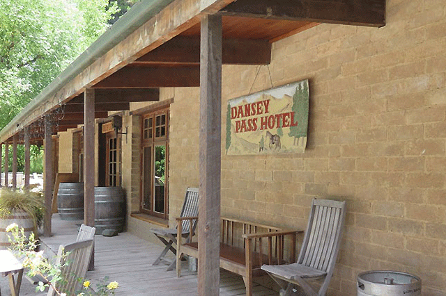
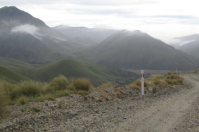
Dansey’s Pass was an ancient route connecting the Maniototo to the Waitaki Valley, traversed by Maori for hunting and as a greenstone trail en-route to the West Coast. Local Maori showed this route to a North Otago runholder, William Dansey, as a good pathway to access the Maniototo Plain. The full traverse across the pass is a challenging 50km journey, on a narrow and twisting gravel road.
But at least do the drive from Naseby to the coaching inn – it’s a breeze.Another sublime Maniototo ghost town also requires a slight detour from SH85, on a lonely looping gravel road to reach St. Bathans. At last count, there are only 6 living inhabitants left – but no shortage of ghosts, apparently. “The Rose” is the most celebrated spirit, a prostitute who serviced the Vulcan Hotel over a century ago.
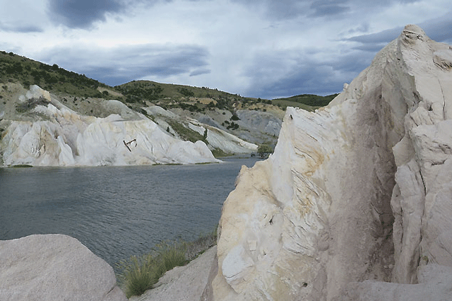
Her enduring presence makes this movie set-perfect one horse town a perennial hotspot on the paranormal tourism map. The dramatic man-made Blue Lake, nicknamed the Glory Hole, was the deepest mining hole in the Southern Hemisphere, for a time. 69 metres deep, the huge pit was cleaved out of Kildare Hill over seventy years. Later filled with water, the abundance of minerals in the surrounding rocks give the lake its arresting turquoise hue.
Chat to the locals and they swear the lake is haunted. Some believe the ghosts of goldminers can be seen rising from its depths after dark. The irresistible Vulcan Hotel is the only surviving pub in St. Bathans, and one of the oldest mud brick adobe buildings still standing in New Zealand. Room 1 is apparently home to “The Rose”, who was strangled in the pub in 1880. Numerous guests vow and declare they were grabbed and held down in the night, while a striking photo of a cloaked ghost is on display in the pub – snapped at the window of Room 1 in 1995.
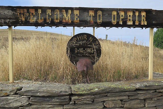
If you’re feeling particularly intrepid, request a night in Room 1, nocturnal visitations might well be included. Apparently she’s particularly partial to terrifying male guests. You can also stay at the old St Bathans Police Camp, established in 1864, with superbly appointed accommodation available in the Constable’s Cottage and St Bathan’s Jail. Another essential Central Otago village, tucked away on the edge of the Maniototo is Ophir.
Pronounced by the locals as Oaf-ah, this pint-sized hamlet ranks alongside St. Bathans and Naseby as one of the country’s most authentic gold rush settlements. Grab a walking map and soak up the parade of historic buildings that line the main street, headlined by the Ophir Post Office. This sublime stone structure, built in 1886, has the unique distinction of being the oldest continually operating post office in the country.
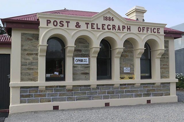
Ophir is proof positive of how a settlement that could easily have slid into obscurity is enjoying a grand renaissance on the back of the Central Otago Rail Trail, which rolls through town. Tourism is the lifeblood of this gold mining ghost town, revitalising the trove of legacy cottages and buildings, crafted in local schist stone and mud brick.
In a stark reminder of the climate extremes, where the summer mercury can soar into deep in the 30s, Ophir clocked up New Zealand’s second coldest recorded temperature in 1995, when the winter chill plunged to -21.6C. It has only been beaten by Ranfurly, which dipped to -25.6C in 1903. Don’t miss the river-spanning spectacle on the southern outskirts of Ophir: the Daniel O’Connell Bridge.
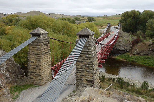
Erected in 1880, this is one of New Zealand’s oldest surviving suspension bridges, a stirring sights towering above the Manuherikia River with its iconic solid schist piers and russet red railings. When the bridge was first completed in 1880, a whole roasted bullock was consumed to celebrate its opening.
The 150km Otago Central Rail Trail, which runs from Clyde to Middlemarch, is New Zealand’s first and longest rail trail, which opened in February 2000 and served as the lodestar for the national network of cycle trails that have since sprouted. Following the path of the old railway lines, it can be accessed year-round by mountain bikers, walkers and horse riders. For more information see www.otagorailtrail.co.nz



Recent Comments